18° Clouds
11 km/h Wind Speed
Desfiladero de los Gaitanes Natural Area and Caminito del Rey

Short Trips

Desfiladero de los Gaitanes Natural Area and Caminito del Rey

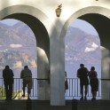
The river Guadalhorce travels through the gorge after passing through the El Chorro, Guadalhorce, Guadalteba and Gaitanejo reservoirs. The need to cross this range gave rise to the construction of water infrastructure to facilitate the connection, as the area is a strategically located enclave, a path to the heart of Málaga province. The Caminito del Rey ("The King"s Path", so named because it was opened by Alfonso XIII) was built onto the walls at the opening of the gorge. The path is a pedestrian walkway almost 3 kilometres in length running along the wall of the ravine. Sections of it are one metre wide and hang up to 105 metres above the river. The walkway was refurbished and reopened to the public in 2015. However, the full length of the Caminito del Rey is 7.7 kilometres, of which 4.8 are footpaths and 2.9 are walkways.


Info + Pic:© 2018 Turismo y Planificación Costa del Sol S.L.U

Desfiladero de los Gaitanes Natural Area and Caminito del Rey
DURATION 3 Hours
  • Conde de Guadalhorce Dam

    Next to the north entrance to Caminito del Rey.

    1
  • The chair of King Alfonso XIII

    Before the north entrance to aminito del Rey.

    2
  • North Access to Caminito del Rey

    You need to buy the tickets first in the official website.

    3
  • Puente Colgante Caminito

    The Desfiladero de los Gaitanes gorge, covering 2,016 hectares and granted Natural Site status in 1989, runs through the Sierra de Huma and the Sierra de Pizarra to the cliff and the gorge that bears its name. This natural space, which belongs to the municipalities of Antequera, Álora and Ardales, is over five kilometres long with a ravine whose steep walls are up to 400 metres high.

    Info:© 2018 Turismo y Planificación Costa del Sol S.L.U

    4
Other Short Trips